 I just bought au's A5401CA cell phone with digicam. The good thing is that it can attach location info to photos via au's GPS functionality. Cool.
Here is a moblogged pic taken at Shibuya, Tokyo, with location info. The cell phone automatically attaches the map info, but there is a finding re: the location info. Given the geographic position such as longitude, the location is displayed at different points depending on maps. Here are samples.
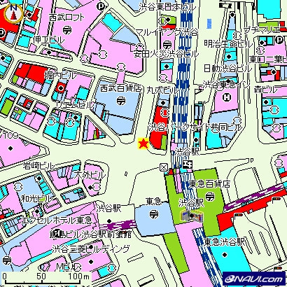 This map info looks very accurate. Error is only some ten yards, proving that the cell phone gave me that the location info is "Grade A" out of three grades (meaning the cell phone gets highly trustful data).
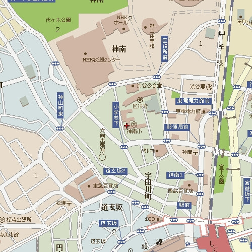 But I am familiar with Mapion's online maps, so wanted to show the map of Mapion using given geographic postioning data. Surprisingly, the position shown in Mapion's map (left) is very different from au's one. Error seems some 500 yards.
After I blogged this phenomenon in Japanese, good comments were posted. Here is a summary: There are two types of geodetic standards and location info by GPS cell phones is based upon the global geodetic standard. The government started adopting the global standard since April 2002, but some map services in Japan are still based upon the domestic (Japanese) standard. There are about 500 yard difference in locations b/w by the glocal standard and the domestic one.